 I’m no master…but I do have my own thoughts on some aspects to the the sport of ski mountaineering.
Ski descent ratings can be very helpful when traveling to a new area or trying to describe the line you just skied. Unfortunately, unlike climbing, there isn’t a universal system that has been adopted by skiers. There are a few systems out there that have been developed to help do this, like the Toponeige, S-System (or Traynard Scale) and the Alpine Grade for Ski Alpinism developed by the Swiss. His royal blogness, Lou Dawson, even has his version called the D-System.
Now, all these rating systems have their own benefits and most try to describe both the exposure and steepness of the route. Some, like the Toponeige, even work the ascent difficulty into the rating.  Others, like the S and D-systems, divide the rating levels into as few as 7, to as many as 23 levels of difficulty. Combine these with the Alpine Grade from the Swiss, which describes the slope angle, and one can get a fairly good idea of what to expect when dropping into a new line…assuming you know what the specific number and letter combination mean. I feel this is the one flaw to these systems and often it seems to be a little bit subjective. Why not just state the angle of the descent and difficulties encountered, instead of correlating it to some arbitrary number or level?
Instead of trying to come up with a number or letter to describe the difficulty of a ski descent, why not just include route specifics in the rating. For example, here are some ratings for some Teton lines, the Southeast Couloir on the South Teton, the Hidden Couloir on Thor Peak and the Ford/Stettner on the Grand.
The first part refers to the location and/or approach difficulty of the route and grades range from I-V. A higher number means that the descent is logistically harder to get to. It’s pretty easy to get to the Southeast and Ford/Stettner in winter, as long as you are relatively fit,  so they get a pretty low rating of II (maybe III). But the Hidden Couloir requires a whole day of approach, without motorized assistance of course, prior to the descent. These ratings should be given for the winter accessibility conditions as opposed to a…after the road is plowed…or lake melts out scenario.
The next number refers to the overall length of the route in vertical feet. For the Hidden Couloir, this number describes the couloir itself and not the rest of the skiing one does to get back down to Bearpaw Glacier, which would add about another 1000′. The slope angle comes next, and I would say this should be noted as the average angle and not the steepest part of the couloir. I say this due to the variability of steepness one encounters form year to year depending on snow depth. Generally speaking, the more snow there is…the less steep the angle would be of a route. But this sometimes works in the opposite direction at the top of a couloir that is overhung by a cornice.
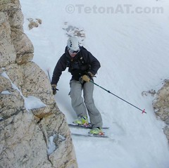
 Straight lining the exit couloir below the Southeast Couloir on the South Teton
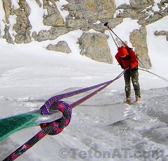
The fourth part of this description refers to specific aspects or technicalities one may encounter on the descent. If a line can be skied cleanly there would be nothing listed here. Some characteristics would include: SS=side-stepping/slipping, DC=down-climbing, RP=rappelling or even SL=straight-lining. I think these parts of the equation would vary considerably depending on the skier’s abilities and conditions of the route.
I’m sure many people out there think all this stuff is just hot air, but I feel like as the sport of ski mountaineering progresses and more people travel to different areas to rip the gnar, ratings like these can come in very handy in choosing your objectives.

I like it, Fact is, and the main problem with the numbered rating system, is that the number can vary greatly depending upon conditions at any given moment. This suggestion merely gives you the basics, and keeps the actual difficulty aspect open for interpretation on the day of descent. This system would seem to avoid the “sandbag” rating that can so easily result from one’s reliance on a numbered system as the inspiration for their decision to ski the line.
I really like the simplicity of this system. It only gives the minimum amount of information (in a good way), therefore there aren’t any misgivings about variable conditions. The only concern I have is with the “average angle of decent”. I wonder if it wouldn’t be a good idea to put an average slope angle and include another piece of data that would be the max slope angle. My thought process on that was that someone might see the average angle and think it could be 45 deg and be ok with skiing it, but it may have a section of 55-60 deg that they may not be ok with.
I prefer the binary rating scale. Can I ski it? Yes or no.
Yes…to rip…or not to rip. That is often the question! 8)
Chris…I see your point in wanting to know the steepest part of the couloir…but this is where I feel the snow depth/conditions will have the greatest influence on the slopes pitch. Often, the steeper sections of couloirs are where there is a chockstone or other feature that just needs more snow to cover it up…and make it less steep.
In my experience, most steeper sections of couloirs are relatively short (say 10-20′)…until you are able to get around an obstacle of some sort. The question is…is the slope angle of a coulour decided by a 10-20 section…or on the remaining 1000′.
Steve
My friend uses a two bit binary syatem…
Can I ski it?
Would I ski it?
The binary system is good and all…if you can see the route you want to ski…and know the current conditions.
But I feel more information on the specifics of a line is nice to have when researching lines not in your home range. 8)
I like it. Seems a lot simpler and more informative than some of the others without having to remeber what each number means.
I put in quite a bit of time researching different difficulty ratings (the web pages for traynard, toponeige and swiss ratings are on my site) and in the end I came to the decision that the best descriptor of route difficulty is a short written description that includes overall length and steepness, crux steepness, and exposure plus any special comments. Initially I had a strong desire to quantify ratings for comparison sake, but in my mind a brief 1 or 2 sentence description works best.
– my 2 cents